Improved BRS/EBS P35 Boundaries
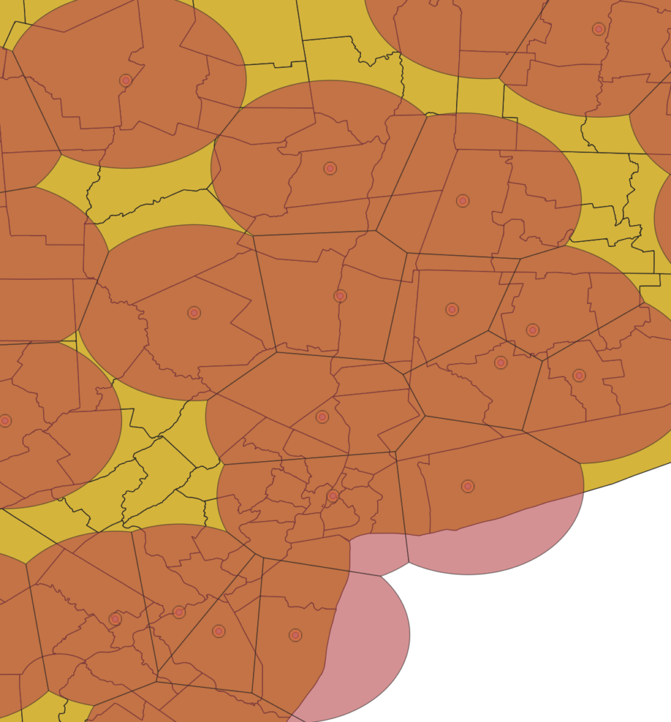
BRS and EBS licenses are licensed in a variety of ways (and the upcoming Auction 108 will add another way – counties). One of the way they’re licensed is a Point-Radius method referred to as P35 (point and a 35 mile radius). Licensees define a point, and have the 35 mile radius around that point as their licensed area. However there are lots of cases when those licenses overlap. Which can make it tricky to know which license is the correct one for a given location.
Using a “splitting the football” technique to intersect P35 point/radius license areas, I am better able to determine the county/license relationship. Counties in metropolitan areas will have less noise and more signal (ha ha) as far as which licenses are applicable for that area. In very dense areas, like the picture below, you can see that it becomes less of “splitting the football” and more of just trying to determine the midpoint between all the intersecting points and drawing lines through the midpoints to generate a set of boundaries that are correct.
This was a particularly fun problem to solve. It took a while, as the spatial analysis tools in SQL Server weren’t adequate and I had to spin up a different database to accomplish it.
These improvements will be deployed by the end of May!
More improvements to come soon!